|
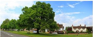
| The Green |
The village of Hallow lies on the western side of
the River Severn just north of the city of Worcester. The western boundary has
altered over the years but is now defined by Laugherne Brook which divides
Hallow from the nearby village of Lower Broadheath. The parish includes the
hamlets of Little Eastbury, Shoulton and Hallow Heath.
Hallow
(Haleghan) is recorded as a gift from King Offa to Bishop Mildred in 816AD and
was prized by the monks as a health resort, providing fish, doves, rabbits,
swans and produce at least until the 13th century. The Prior of Worcester
obtained license to impark 60 acres of land and 40 acres of wood in 1312. The
manor of Hallow at that time was without a house. The manor and park was leased
by the Bishop from 1550 onwards. Queen Elizabeth 1 hunted deer in Hallow Park
in 1574 on her Royal Progress.
The lands on
the banks of the Severn are low lying and prone to flooding, being only 44ft.
 |
| Hallow Church |
above sea level, but Hallow lies on a fertile ridge which carries the main
road from Worcester north east to Tenbury. The Severn was navigable and
tidal and could be crossed at low tide in Hallow and by ferry to the north and
south of the village. Much of the land is still used for market gardening
and other agricultural use with several working farms still in existence. The
village centres on a triangular village green around which a number of
businesses including a forge, bakehouse, shops, malthouse, garage and public house
have traded in the past but now is wholly residential.
The church, built in 1867 is the focal point of Hallow,
standing on high ground on the Main Road. It replaced earlier churches located
at the end of Church Lane close to the river.
 |
| The School |
Thanks to a
generous endowment by Anna Bull, Hallow has had a school for boys and girls for
300 years, founded in 1712. Amy Wheeley Lea (widow of Charles Lea of Lea and
Perrins Worcester Sauce) was also a generous benefactor to Hallow and Worcester
and many properties in the village owe their existence to her munificence.
LISTED BUILDINGS:
There are a total of 18 listed buildings in Hallow. To read details click here.
 |
| Hallow Green |
LOCAL GEOLOGY:
The subsoil of North Hallow consists of multiple layers of mudstone and
siltstone of Triassic age which occurs beneath parts of eastern Worcestershire,
the Midlands and neighbouring areas such as Cheshire, Nottinghamshire, Devon
and northern Yorkshire. Once known as
Keuper Marl, the layers are typically red, or occasionally green or grey,
generally featureless and contain few fossils.
Sometimes present at the base of the marl can be thick halite-bearing
layers, or rock salt deposits.
CENSUS INFORMATION MAY BE VIEWED HERE BY CLICKING ON THE DATE REQUIRED
1841 (District 6)
1841 (District 7)
1861 (District 4)
1861 (District 5)
1881 (District 4)
1881 (District 5)
1911 (District 6)
THE PARISH HALL OF HALLOW
Hallow
Parish Hall celebrated its 90th year of operation in 2020. It is held in trust by Hallow Church and
leased to a Committee who run the day to day activities and are responsible for
any alterations made since its opening in May 1930. The Committee is currently compiled of 4
independents and representatives of local user groups and meets periodically
throughout the year.
The
Hall stands on land bequeathed to the village by Joseph Banks in the 1920s and
local people raised money to build the current structure.
Since
opening in 1930, Hallow Parish Hall has hosted many hundreds of events which
include children’s & adult parties, wedding receptions, funeral wakes, horticultural
shows & meetings , quizzes, WI events & meetings, bridge & whist
drives, exercise classes, pantomimes, dances, fund raising events and others
too numerous to mention. For some years
it has been the permanent home to Hallow Playgroup, now Hallow Pre-School.
Official
Opening – Hallow Parish Hall, 24 May 1930
Back Row – from Left
Chris Locke
(1st Secretary Hall Committee), Mr. Bill Hearn (The Furlongs), Mr. Fred
Griffiths, Mr Harry Calloway, Mr. Knowles, Unknown, Mr. Locke (Elmley House), Mr.
Mole, Mr. Arthur Lord (Hallow Mount)
Front Row – from right
Mrs Cherry,
Reverend Stallard, Mrs Wheeler (Heath Farm), Mr. Cherry (Banker & Chairman
WRI), Mr Joseph Banks, Mrs Banks (Hallow Park), “Mini” Calloway, Mrs Dorothy
Collett, Mr John Collett (Mr Banks’ Daughter & Son-in-law)
--------------------------------------------------------------------------------------
THE PLAYING FIELD OF HALLOW
An article was
printed in October 5th 1931 edition of The Times Newspaper, as follows –
VILLAGE PLAYING FIELD IN
WORCESTERSHIRE
The first
playing field in Worcestershire secured through the medium of the National
Playing Fields Association was formally opened by Major J. M. Reddie, chairman
of the executive of the Worcestershire Playing Fields Association, at Hallow,
near Worcester, last week.
The field had
been originally refused by the parish council on the ground that it might
involve the levying of a rate. The donor of the field, Mr. J. Banks, however,
induced the National Playing Fields Association to accept the field, and the
association arranged with the present parish council to accept a lease of the
field for 200 years at a nominal rental of 1s.a year.
Mr. B. Noake,
who presided at the opening ceremony, expressed regret that Lord Cobham, Lord
Lieutenant of the country, was unable to be present because of illness.
------------------------------------------------------------------------------
The following item appeared in the Parish Magazine, September 2019:
Whatever happened to Hallow’s common
land?
The village of Hallow would have looked
very different in 1815 in the year of the Battle of Waterloo. There were areas
of commons and waste known as Windmill Common, Old Field; The Raynes/Reins
(later the site of the present church) and about 10 acres known as Hallow
Heath. The Heath common land was dotted about the village, some was to the
North of the village on both sides of the Moseley Road at the junction with the
main road and also a narrow ribbon of land in Moseley Road beyond the entrance
to Heath Farm around the area now known as Flatten Bank and a smaller narrow
strip on the other side of Moseley Road.
Colin and Diane Cartridge who live at
Rosedale, Moseley Road, kindly let me look at their old deeds and those
together with the 1816 Allotment of Hallow Enclosure, have helped to show how
Hallow developed after the commons were enclosed. Samuel Bourne, a Shoulton farmer was entitled
to just over 3 acres and was given three plots of common land. The larger plot
of land stretched from before Heath Farm in Moseley Road to approximately the
site of Salven Acre and Heath Terrace on the main road. The other two plots
were in the long narrow strip to the right of Moseley Road from the main road. By
1821 Samuel Bourne had put the narrow plots of land in Moseley Road up for
sale, the larger plot between Moseley Road and the main road remained for the
time-being in the family.
 |
| FLATTEN BANK 1816 |
It is possible to pick up the trail
again of the Flatten Bank strip in the 1841 census, when tithe field number 355
contained an un-named Cottage & Garden which was owned and occupied by the
Hammond family, but was that Rosedale or another nearby cottage? On 13 October 1864 31year-old Ellen Hammond
married local builder Joseph Fortey aged 34. Before the marriage it had been
agreed that Joseph would buy the un-named property for £160 so that all the
Hammond sisters would have their share of the inheritance following their
brother’s death.
Rosedale’ deeds include a 30th
January 1922 document in which William Smith, a labourer who had lived in the
village for 80 years, made a sworn declaration that in about 1865 Joseph Fortey
built two cottages in the grounds of Rose Cottage which he owned and which was
then occupied by William Potter a shoemaker. So that seems to date Rosedale
Cottage and adjoining Flatten Bank Cottage to about 1865, with Rose Cottage
having been built before 1841. By 1881
Joseph & Ellen Fortey and their four children were living at Walnut House. Joseph
employed 8 men and a boy. He was amongst the builders who bought the timbers
etc from the 1830’s church when it was demolished in the late 1860’s and no
doubt those timbers were “re-cycled” in houses in and around Hallow. On 30th September 1921 Joseph and
Ellen Fortey’s surviving children, Henry Fortey – Railway Clerk of Windsor
Cottage, Lucy Moon - a local teacher and Mary Ellen Lock - wife of Henry Lock
innkeeper at the Crown Inn, decided to sell the Fortey’s 19th
century properties including Rose Cottage, Flatten Bank Cottage and Rosedale.
 |
| FLATTEN BANK 2019 |
If you live in Hallow and are willing to
let the History Group look at your deeds, it should be possible to draw up a
more detailed picture of how Hallow developed in the 19th century.
If you are interested please contact us.
Jacquie Hartwright